Welcome to TrailBandit.org

This web site started out as a guide for people coming to the beautiful island of St. John in the United States Virgin Islands. My intent was to share the map of the island that I made so that people new to the island would be able to find their way around. I found that the map provided by the National Park Service was almost useless and that other available maps were inaccurate and incomplete.
More recently, I made a map of the Ossipee Mountains in New Hampshire. The only maps I found that covered the whole area were made by the United States Geological Service. Although these maps are accurate and very professionally done, there is very little hiking trail information shown. I met a gentleman, Dave Roberts, who gave me a copy of his superb map of the Castle in the Clouds area. I have expanded on his work and produced my map that shows the entire mountain range. I hope you will find it useful and enjoy this beautiful area.
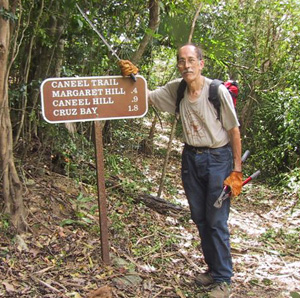
I chose the name “Trail Bandit” because I have found that getting permission to do maintenance on old trails is essentially impossible and I decided that if these trails were to continue to exist, I would have to do the maintenance myself, with help from others. As you might expect, I have encountered resistance to this practice along the way.
If you just want a good map, go to the “Free Downloads” page where you can download the maps and other information for free. If you would like a printed copy of my maps of St. John or the Ossipee Mountains, go to the “Paper Maps” page to find out how to order copies. For those of you who use GPS technology, you can download my maps in .IMG format that can be loaded onto your Garmin GPS receiver. The instructions for doing this are available in the internet. Also on the “Free Downloads” page, there is a file of the GPS tracks, in .GPX format, for the 33 more obscure and unmaintained trails described on the back of the St. John map. It seems like everybody has one of the new cell phones with a built in GPS receiver. If you are going to St. John, I highly recommend that you get the St. John Off the Beaten Track APP . Load the APP someplace where you have WIFI. When you are out hiking, turn off “roaming” on your phone to avoid big phone bills and a lot of information you don’t need on the trail. A phone connection is not required to use the app. I find having a paper map is a big help for looking at the big picture of where you are. The map on both the printed version and the APP are identical. The book “St. John Off the Beaten Track” by Gerald Singer is superb and well worth every penny.
The purpose of putting this data here is to help others enjoy these two beautiful areas. You may copy or use the map data for any purpose you want. You may reprint any or all of the maps but I ask that you either leave off the reference to the Trail Bandit or note that you have published a COPY of my map. I have run across some crummy copies of my St. John map and they give my maps a bad name.
Hopefully you will get out and hike on the trails and help in the fight to keep them open. It won’t be easy.
