My take on the Ossipee Mountains
The Ossipee Mountains are a great area for hiking, hunting, fishing, cross country skiing and looking at mountain views over a mostly undeveloped landscape. Snowmobiles are allowed on a maintained trail that crosses the range. These hills are the remains of an ancient volcano and are known as a volcanic ring dike. It is one of the best preserved ring dikes in the world and you can find a lot more information about it on the internet. Unlike St. John, there is no National Park here and almost all the land is privately owned. There is a lot of fine print on the “private” part.
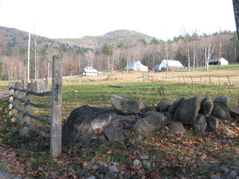
The Ossipee Mountains are located within the towns of Moultonborough, Sandwich, Tamworth, Ossipee and Tuftonboro. The area has been the home and playground for the rich for well over a hundred years. Much of the Ossipee Mountain area is owned by a small, very politically connected group. The owners make contributions to political campaigns and belong to groups that support political candidates. In return the politicians return the favor by funneling public money for land conservation to the land owners. This is known as CRONY CAPITALISM. It doesn’t matter whether you or I don’t like this arrangement. It is how this country and most of the rest of the world works.
I recently read an article in the Wall Street Journal, June 18, 2011, “Death of the Duopoly” It started out with:
“Nothing in American life today seems as archaic, ubiquitous and immovable as the Republican and Democratic parties. The two 19th-century political groupings divide up the spoils of a combined $6.4 trillion that is extracted each year from taxpayers at the federal, state, county and municipal levels. Though rhetorically and theoretically at odds with one another, the two parties have managed to create a mostly unbroken set of policies and governance structures that benefit well-connected groups at the expense of the individual.”
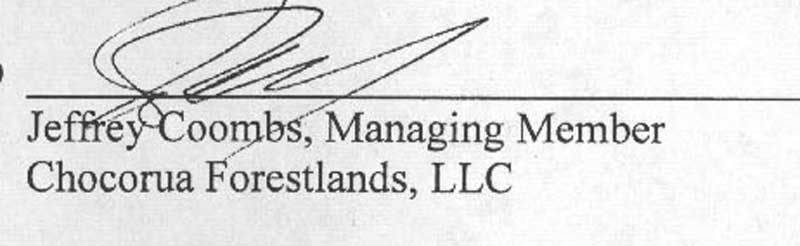
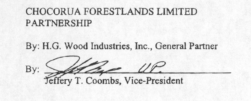
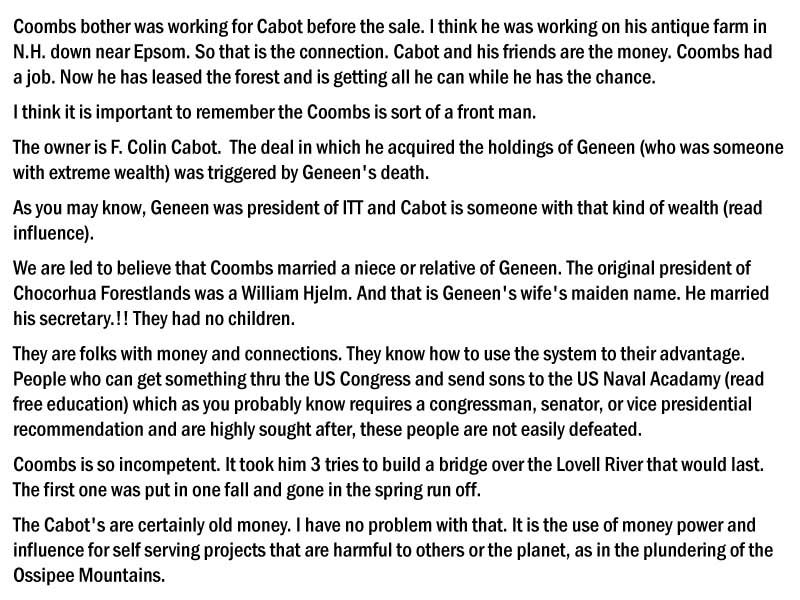
If you spend some time at the Carroll County Registry of Deeds, trying to figure out who owns what, you will run into a number of names of people and organizations that appear over and over again. Chororua Forestlands seems to have collected one of the largest holdings in the area and looking at the history and the list of owners is interesting. Up until the late 1990s a Mr. Harold S. Geneen was owner of Chocorua Forestlands and the associated companies. (His previous life is interesting, see
http://en.wikipedia.org/wiki/Harold_Geneen ) After Mr. Geneen’s death (No, the KGB didn’t take him out) most of the various properties were purchased by Mr. F. Colin Cabot. The name Jeffrey Coombs pops up frequently too. It is a bit confusing, probably on purpose, but it seems that the many companies and LLCs involved are in reality the same couple of people. A few people have shared some of their knowledge of the deals but I cannot guarantee that they have the full or correct story. Their notes are HERE.
As of June 6, 2011 a mortgage deed in Carroll County listed the players as:
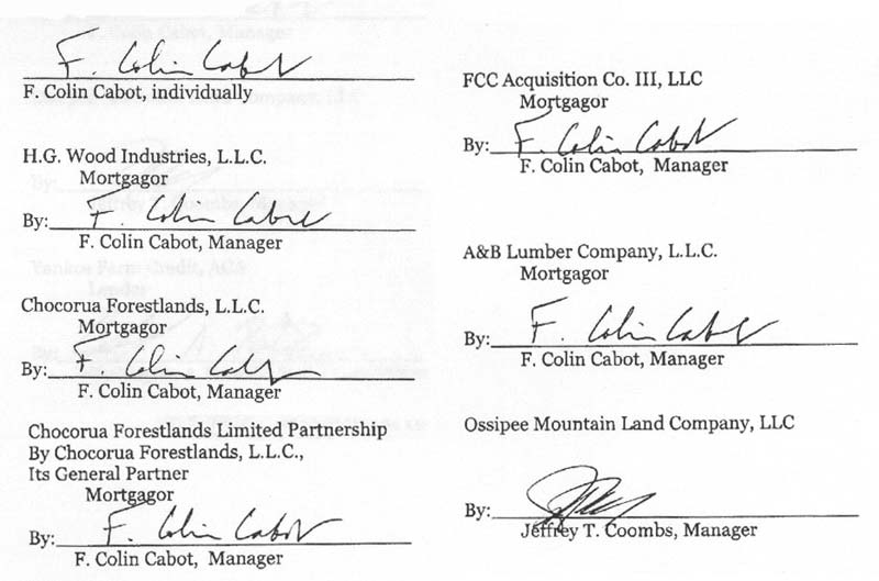
Mr. F. Colin Cabot is a member of the wealthy and influential Cabot family of Boston and New York and there is more at: http://en.wikipedia.org/wiki/Cabot_family .
Ok, I have wandered off the subject of my take on the Ossipee Mountains.
Almost all of Chocorua Forestlands property in the Ossipees has conservation easements that are supposed to guarantee public access and protect the land and waters of the area as well as to prevent the land from becoming another housing development.
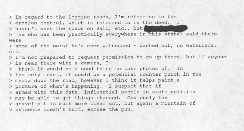
As you will see, they not only don’t follow the rules, but they have done what is about the worst logging job I have ever seen. Their connections seem to make them above the law.
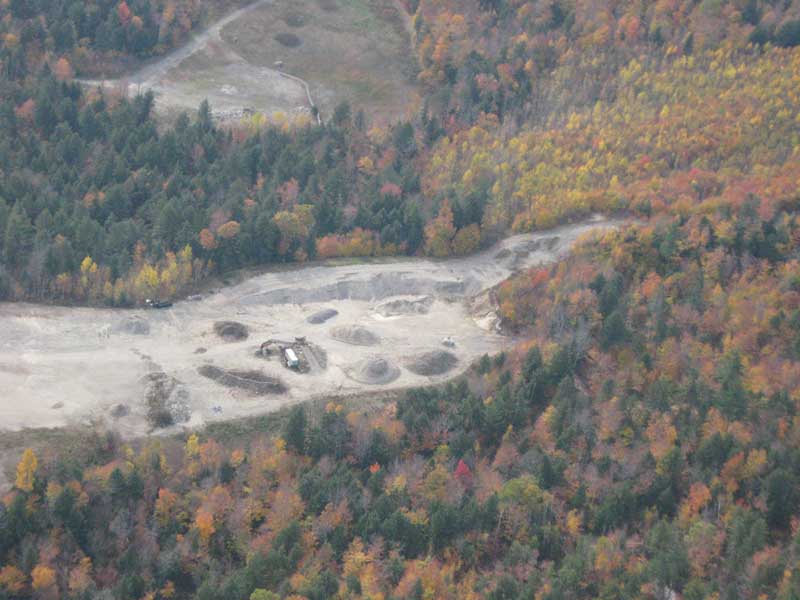
Since there is limited space here for a major rant, I will mostly limit my discussion to one parcel, known as the Ossipee Mountain Forest Legacy Tract and the short story is HERE.
Note the part that says:
"Six miles of maintained hiking trails are also protected from development, including trails that ascend the summits of Bayle and Flagg Mountains."
You will see that $1.4 million of your taxpayer money was handed to Chocorua Forestlands for this easement. A map of what you paid for is HERE..
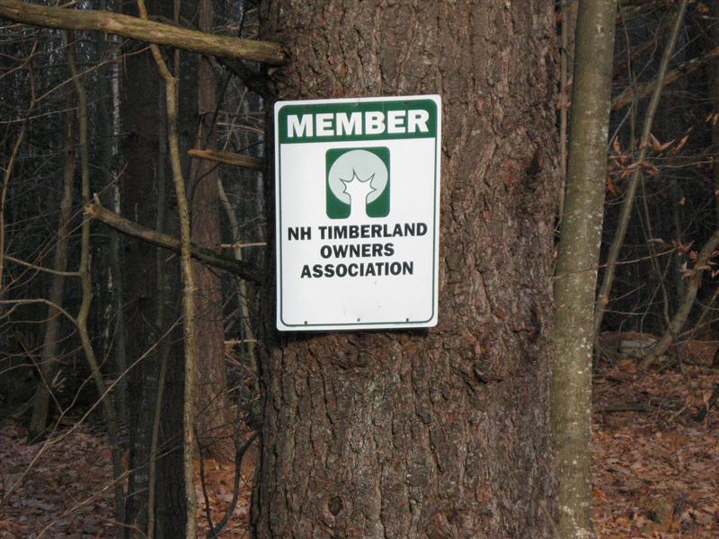
It is also interesting to look at who decides who gets the funds distributed by the NH Forest Legacy Tract Team. Notice that Jason Stock from the NH Timberland Owners Association is the last entry on the Committee.
Download - The Forest Legacy Program
This becomes interesting when you look the past officers of the NH Timberland Owners Association.
Download - Timberland Owners Association
Back when the Forest Legacy Tract money was being funneled to Chocorua Forestlands, Jeff Coombs Managing Member, we see Jeff Coombs listed as President of NHTOA. Paul Doscher, currently on the Forest Legacy Committee is also on the list of past directors of the NHTOA. Another NHTOA director and past president is Chip Kimball. More about him later. It smells a bit fishy when the agency that is handing out our taxpayer’s money is directed by people that are closely associated with those who are getting the funds. Our friend Mr. Colin Cabot has close ties with the people at DRED.
I mentioned crony capitalism earlier.
This oddly shaped parcel is only one portion of the properties of Chocorua Forestlands in the Ossipee Mountains that they have either received a large sum of money to “protect”, or bought at a great discount with a conservation easement already in place. The conservation deed for this tract guarantees public access to the property and describes how the land is to be protected. On the last page of the deed it is interesting to note that part of the Forest Legacy Tract already had conservation easements on it and there were already “A right and easement for a public trail” in favor of the State of NH on two parts of the property. Just what did we get for our $1.4 million? In searching through a lot of deeds, it appears that Chocorua Forestlands got more for the easement than they paid for the land just 3 years before.
It is nice to have connections and have friends in the government that control the purse strings.
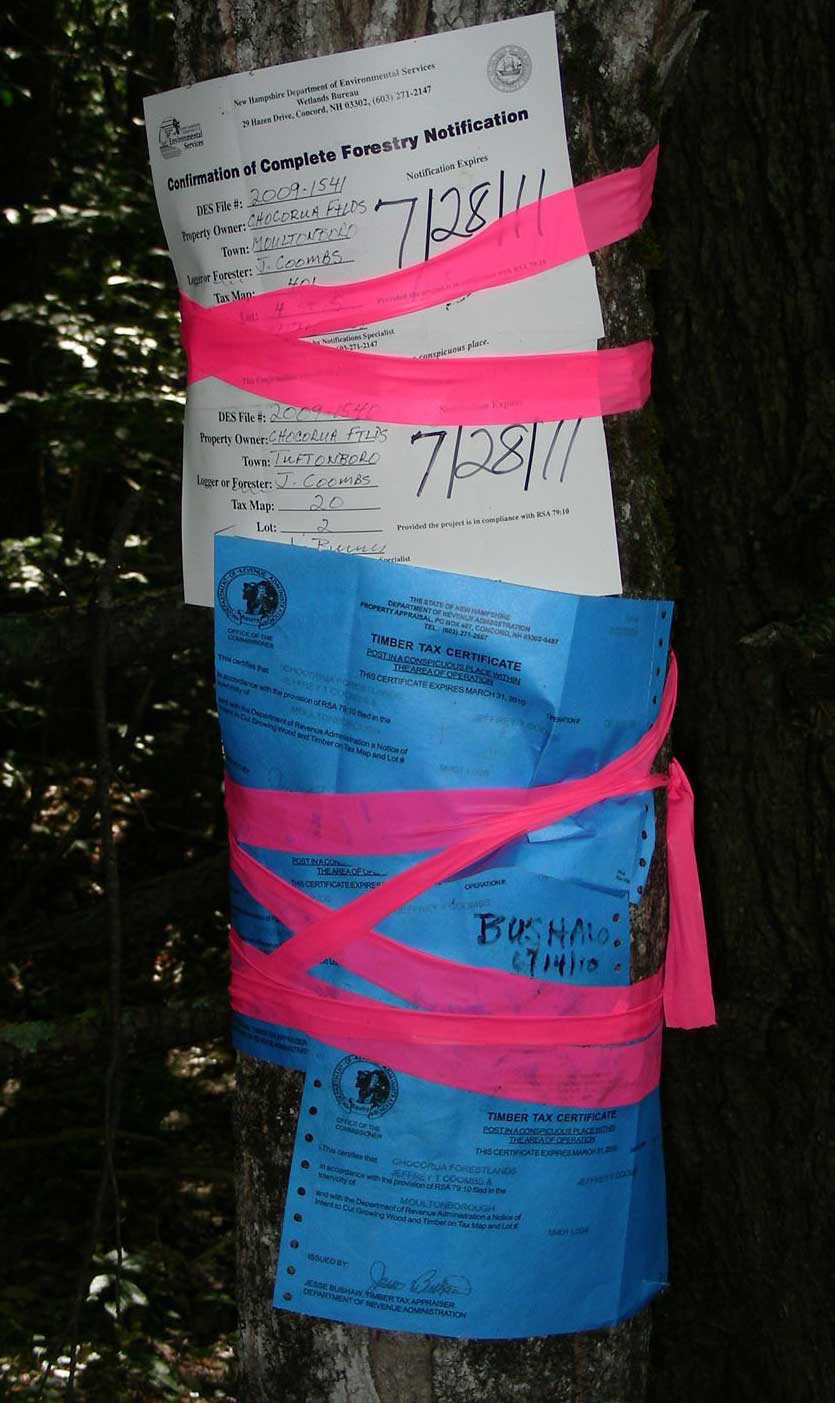
Logging is permitted but must be done under the rules of good logging practice.
See: http://extension.unh.edu/goodforestry/index.htm
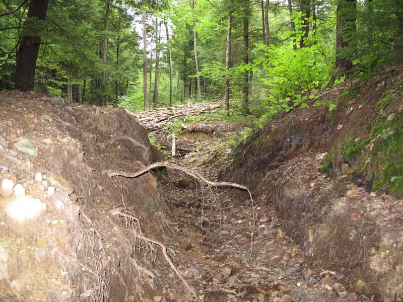
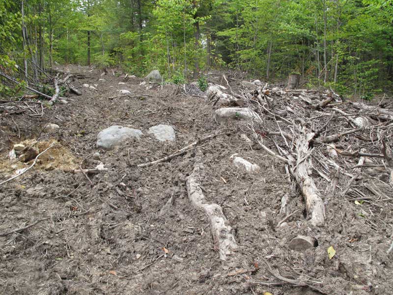
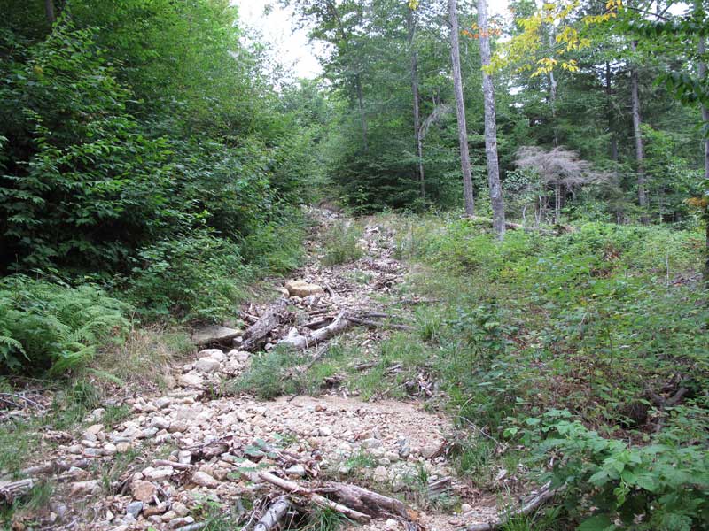
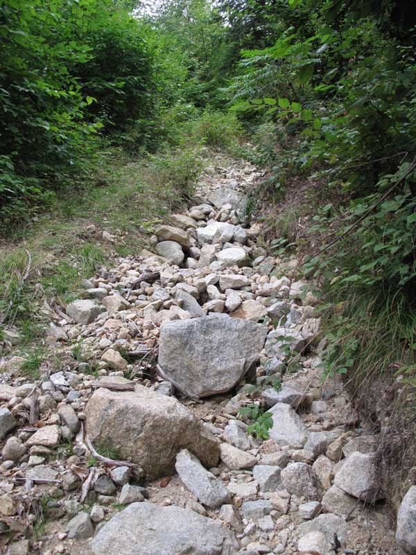
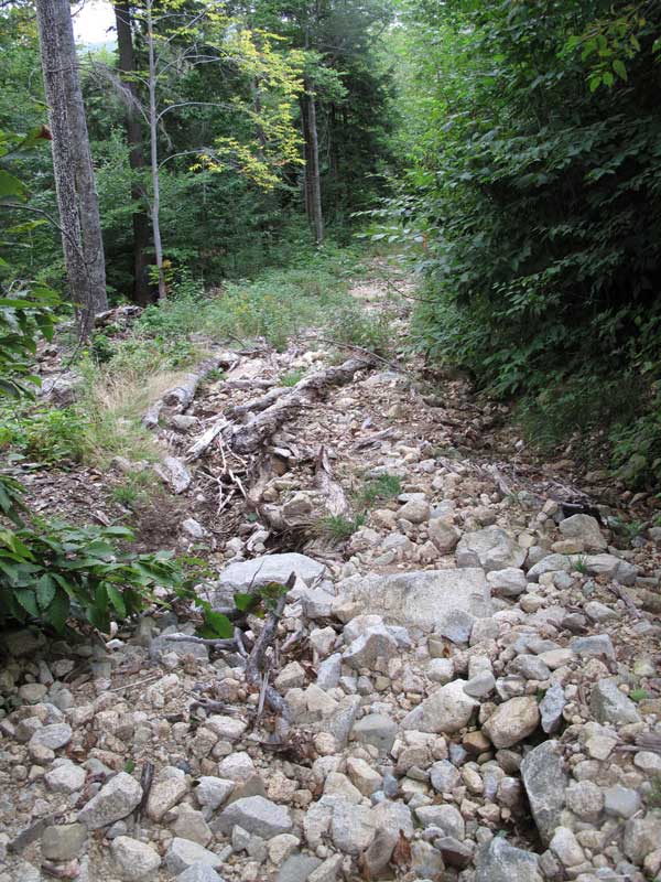
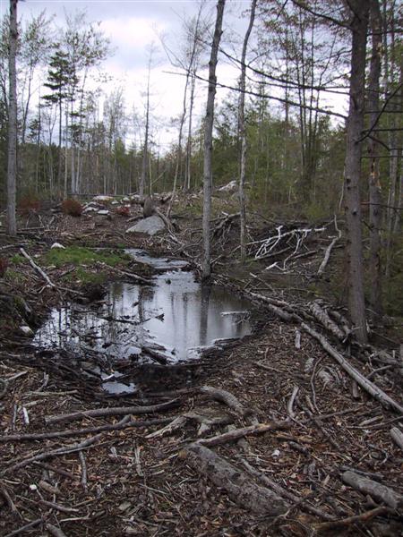
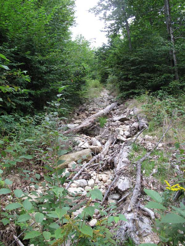
I have walked much of the area and the logging is some of the worst I have seen anywhere. I tried to hire a respected forester to come look at the mess but he said he needed the permission of the land owner first. I knew that we wouldn’t get that. He asked who the land owner was and told him Chocorua Forestlands. He laughed and said “Jeff Coombs is way too well connected, you will never get him.” He was right. Jeff Coombs is the Managing director of Chocorua Forestlands. I complained to the NH Department of Resources and Economic Development that own the conservation easement and provided numerous photos of the logging mess. As predicted, they did nothing. Below are a few photos give a hint as to what has happened out there. Chocorua Forestlands seems to ignore all regulations about proper methods of logging to prevent erosion and runoff from polluting the watershed and streams. Never have I seen a silt fence or hay bales being used to help control the runoff on any of their logging jobs.Below you can see a new logging operation where they dug a ditch to drain water from a logging road. It runs directly into Stony Brook. They seem to have a habit of dragging logs straight down the slopes and the results are predictable. In the old logging road photos you can see what happens to the soil after a few good rain storms.
More photos of the mess can be found at www.ossipeemtnhiker.blogspot.com and a copy is available HERE
All that sediment goes into the brooks. Over the years I have seen Stony Brook, Weed Brook and the Lovell River all run brown with the sediment from these logging operations. Many others have seen the destruction and one report is here.
Again, being well connected allows the cutting of many corners.
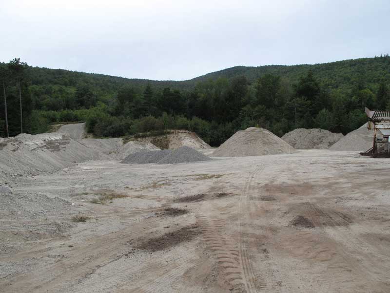
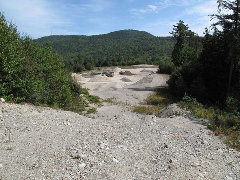
If you read the Easement deed, you will note that there was a gravel pit on the tract that was supposed to be closed and revegitated by 2004. Below are some current photos that show the progress in closing the pit.
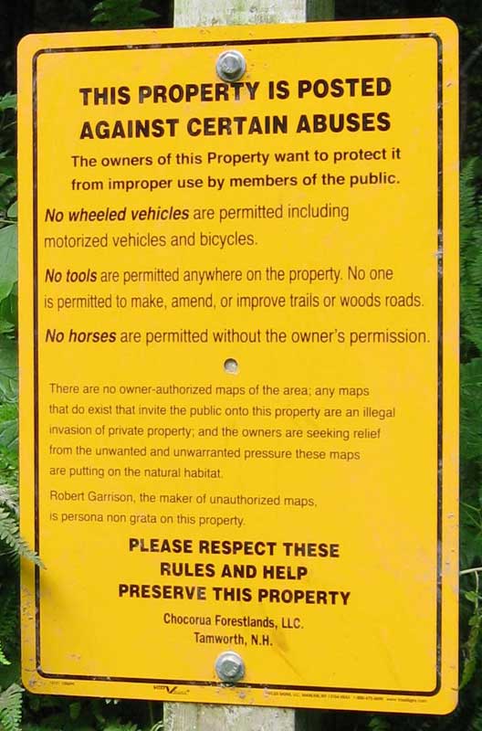
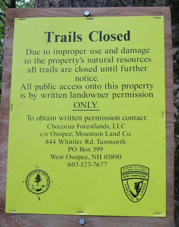
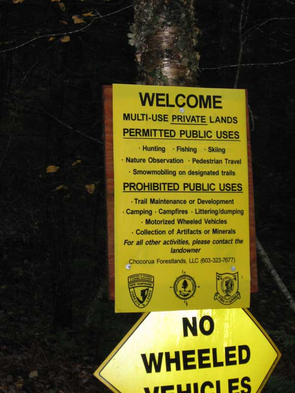
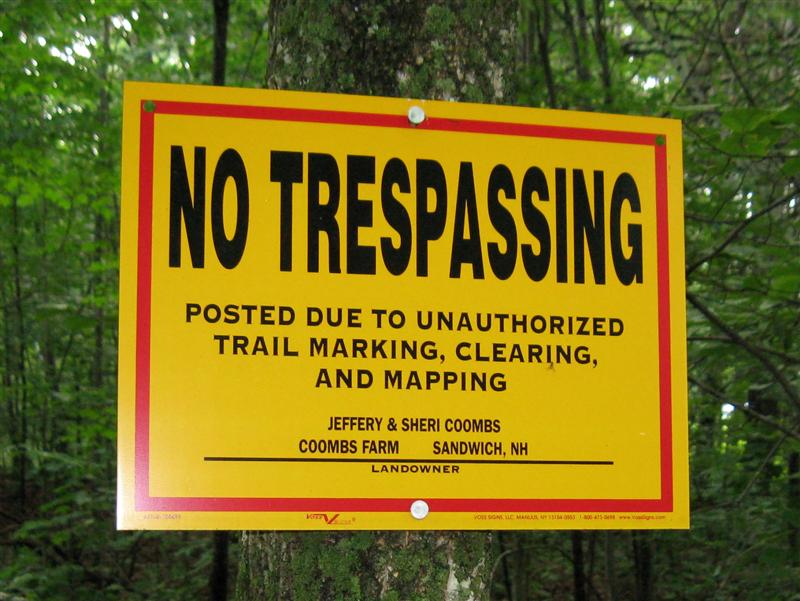
When I published my map of the Ossipee Mountains some of the residents were angry because I was showing where the trails were and how to get there. Jeff Coombs, of Chocorua Forestlands fame is probably the most well connected of the bunch. He put up signs on the Forest Legacy Tract trying to imply that having a map was illegal. See Sign 1 below. After getting support from his compatriots at NHDRED, he got them to close the tract (The easment says he is not allowed to close the tract to hikers, etc. but the easment holder can.) saying that the land had been badly damaged, do in part to my map. A little research found that the damage was that “someone” had done maintenance on the 6 miles of maintained hiking trails mentioned in the easement. After I admitted that I had done some maintenance on those trails, NHDRED reopened access to the tract and put up new signs. See Sign 3 below. You will note that it still is illegal to do maintenance on those “Maintained Trails”. You will also note that Signs 2 & 3 were printed by NHDRED and I assume the tax payers of NH paid the bill. It is nice to be well connected.
Now a bit about Jeff Coombs: I met Mr. Coombs once when I was hiking around collecting GPS data for my map. He was unfriendly and said “We don’t want a map”. After a little research I found that in addition to being well connected, he has his fingers in many of the businesses related to Chocorua Forestlands.
It seems that Mr. Coombs can also sign off on his own logging practices. A recent logging operation on the tract has him listed as the forester in charge. If he weren’t so well connected, he would be liable for the damage to the environment. I guess that the Division of Environmental Services is happy with his work. See the Logging sign below and zoom in to see who is who.
If you care about any of this at least don’t buy products from the Cabot and Coombs many companies.
There are a number of other players in the show. The Kimballs, Susan Bryant and Chip have been active in the protests and efforts to keep my map out of circulation. Also Kate Thompson has been active behind the scenes and is a well known contributor to political campaigns. She sells herself and friends as “Stewards of the land”. I guess my idea of “Stewards of the land” is different from theirs but it does have a nice ring to it.
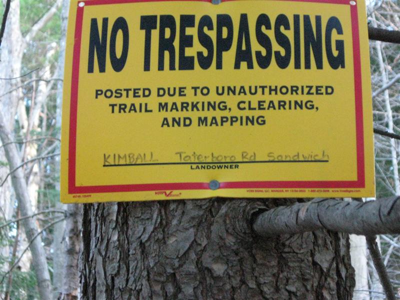
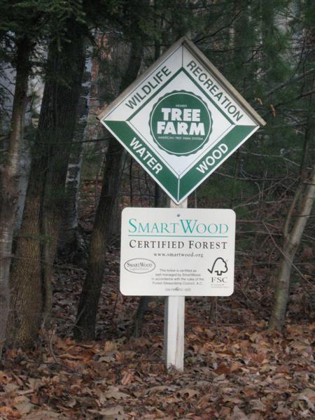
If you track down Jeffery Coombs follow the trail to the end you come to 236 Mountain Road, Center Sandwich, NH. Sign 6 is next to the entrance and might lead you to think that Coombs, is friendly to hikers. In the past he has bullied and harassed many who have entered. I wonder if the “Smart Wood” people have spent any time looking at the local logging practices. Signs 4, 5, and 7 are posted nearby.
Since these people make contributions to various libraries and conservation orginizations, requests by them usually get priority attention. The Gilford, NH library sells hiking maps of the area. I donated 75 of my Ossipee maps to them but shortly after they were put out for sale, someone convinced the library to pull the maps. Also, The Lakes Region Conservation Trust made a new map of their property at the Castle in the Clouds. Someone convinced them to leave out all trails that are not completely on LRCT property. At least the map of the area made by Dave Roberts. which shows all the trails on the LRCT property. is still for sale at the Gilford Library. There was even a bill that they tried to get passed in the NH legislature that would have made it illegal to make a map without the permission of all the land owners involved. It didn’t go very far. Maybe the First Ammendment to the US constitution, that has some words about freedom of the press, still applies.
Among other active players in the area is the Society for the Protection of New Hampshire Forests. In looking through some deeds I noted that a piece of their property was transferred to the Kimballs. Note that Chip Kimball and Paule Doscher were past directors and president of NHTOA and Paul Doscher is running Society for the Protection of NH Forests. It is a closely knit cozy setup.
If you read through the deed to the Kimballs you will note that there is an easement on the property that “Provides for reasonable public pedestrian access for non-motorized recreational activities”. It also includes in the description of the property “a right of way to and from the property, over existing roadways, to the so called Taterboro Road.” If you go to the end of Taterboro Road, you will find a sign prohibiting hiking. The SPNHF easment holders seem to think it is OK for the Kimballs to do what they want.
A number of other SPNHF deeds with similar public access easements went to Chocorua Forestlands. I have included one here because it is interesting to follow. Just before the properties were sold to Mr. Cabot, one parcel was sold to Jeffery Coombs. It is even more interesting when you note that deed from Chocorua Forestlands to Mr. Coombs is signed by Jeffery T. Coombs, Vice President Chocorua Forestlands.
Probably it is not illegal but certainly unusual. This property has the same deeded public access and good logging practice requirements that all the SPNHF deeds contain. Again, the land has been stripped and the public is not welcome.
The Society for the Protection of New Hampshire Forests or SPNHF does a lot of good work by putting easements on tracts of land to protect them from development and also to ensure good forestry practices and ensure public access for non-motorized public access. The sad part about all this is that in the Ossipees, they never seem to do anything to enforce the deed restrictions. Chocorua Forestlands has been totally denuding the place, polluting the streams, etc. and SPNHF has never done a thing.
You would think that a man with the wealth of the Cabots behind him, and whose father dedicated much of his life to building formal gardens, would not allow the rape and destruction of his lands in the Ossipees.
http://en.wikipedia.org/wiki/Francis_Cabot
Ok, you have had enough of this I am sure. The Ossipee Mountains Forest Legacy Tract is your place to hike, etc. The land owner doesn’t want people out there where they can see what is going on and they will fight to prevent any trail maintenance. Remember, you bought “6 miles of maintained hiking trails” and access to the whole place. Take a map and go explore. It is a beautiful area. It is too bad that the trails can’t be maintained. A trail that isn’t maintained is soon a closed trail. The trees will grow back if given a chance, but not in our lifetimes.
If you ever have an occasion to do business with Mr. Coombs, Mr. Cabot, or any of their various companies, watch out. They have a long history to agreeing to things and then doing whatever they want. They break agreements and drag things out in the court system until you can’t afford the legal expenses and give up. Even if you are lucky enough to be able to afford the process and get a judgement against them, they will have the case reheard on some technicality, thus dragging the process out further and costing you more money. It will take years. Good luck!
By now I have broken one of the important rules of story telling here and I apologize to all who have read this far.
”Be amusing: never tell unkind stories; above all, never tell long ones. “
Benjamin Disraeli
